TF / Platform
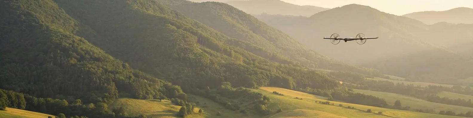
Autonomous systems that touch the earth.
One aircraft, one mission profile: fly to a point on Earth, understand it from the air, land on it, sample it, and report back, with no operator in the loop.
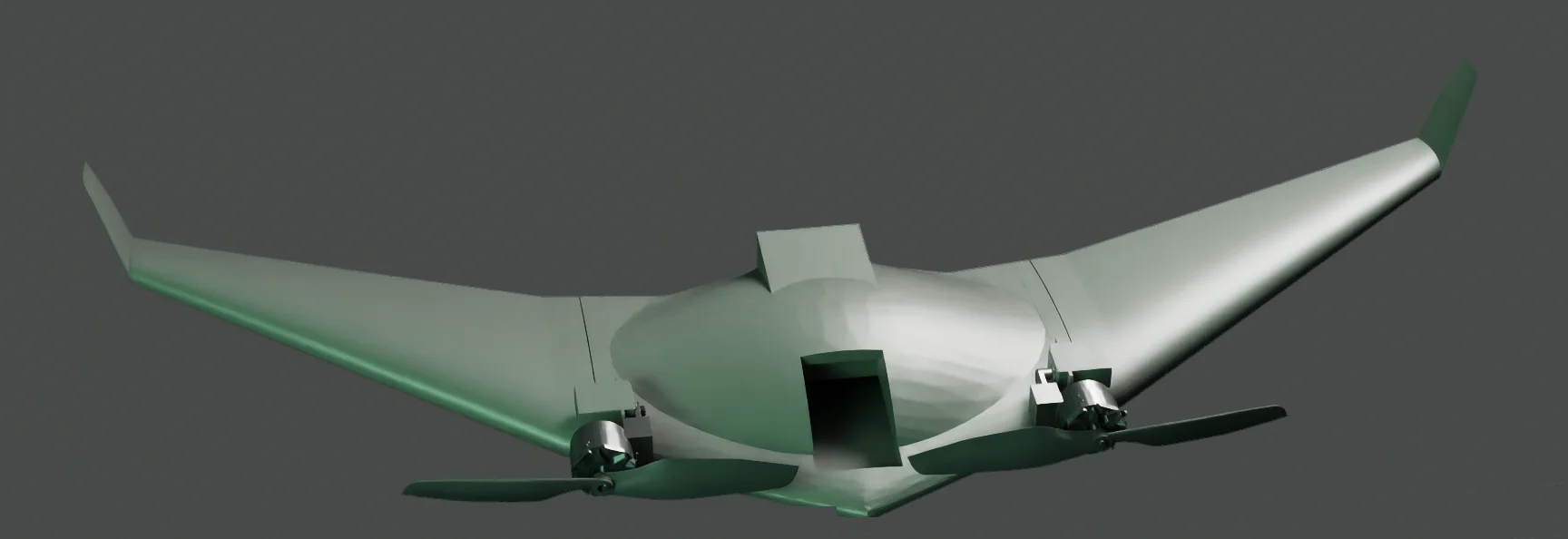
001 / The aircraft
Every layer of the stack, engineered in-house.
002 / Mission profile
Four phases. Zero operators.
Survey
The aircraft flies an autonomous coverage pattern over the target area while on-board vision models classify terrain and vegetation in real time.
Land
On-board perception selects and verifies a safe landing site at points of interest identified during the survey. No prepared surface required.
Sample
The retractable soil probe deploys on contact. Ground-contact data is fused with aerial imagery into a single verified record.
Transmit
Findings are compressed on the aircraft and sent over cellular or satellite. Decisions move in seconds.
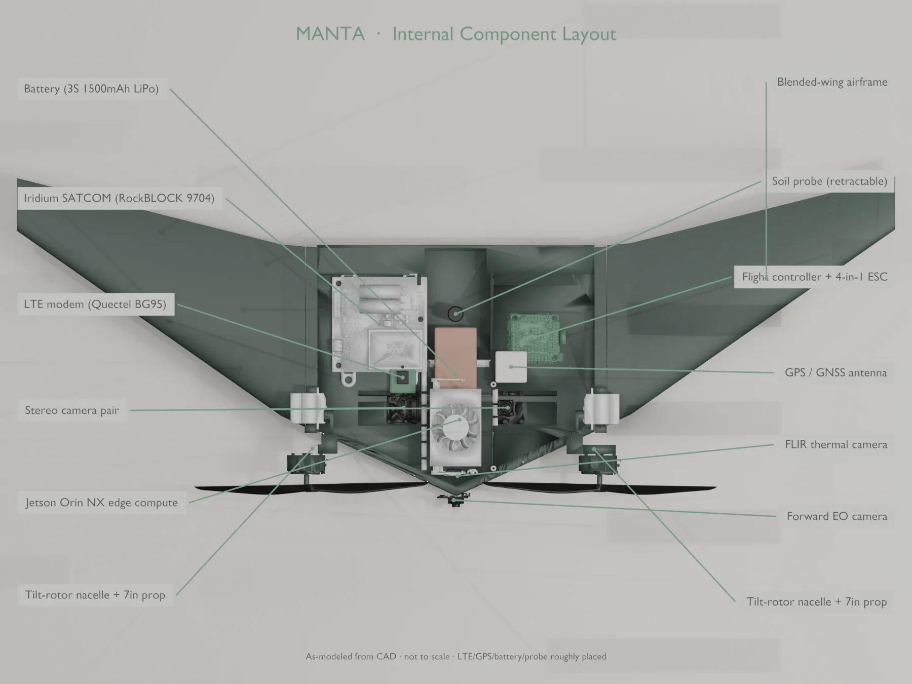
003 / Subsystems
What's under the skin.
Blended wing body
The entire airframe generates lift. That efficiency translates directly into endurance, range, and payload margin, and across a fleet, into mission economics conventional multirotors can't reach.
On-board visual intelligence
Stereo vision and vision-language models run on NVIDIA-accelerated edge compute. The aircraft doesn't just record the world. It understands what it's looking at, in flight, without a link to the cloud.
Direct ground measurement
A single integrated retractable probe is what separates ground truth from inference. Subsurface conditions are measured at the point of contact, geotagged, and timestamped: research-grade data with full provenance.
Edge flight autonomy
Obstacle avoidance, landing-site selection, and dynamic mission replanning all run on the aircraft. Connectivity loss doesn't end the mission. The system completes its objectives and reports back when a link returns.
Bandwidth-aware architecture
Raw sensor streams are analyzed and compressed on-board so the uplink carries decisions, not pixels. The same architecture operates over cellular where coverage exists and satellite where it doesn't, anywhere on Earth, including nowhere.
004 / Platform sheet
The platform at a glance.
Detailed performance specifications available under NDA.
005 / Ground segment
From aircraft to answer.
Mission planning & control
Plan coverage, monitor the fleet, and stay inside airspace constraints, with weather integration and no-fly-zone compliance built in.
Analytics & integration
Verified measurements flow into customizable dashboards, automated reports, and the GIS platforms your team already uses.
Operations support
Training, technical consulting, and mission-critical support for programs that can't afford a gap in coverage.
006 / Demonstration
See the platform fly.
Request a personalized demonstration and a detailed technical briefing.
Request a demo